


Item Number: 010-C1342-00 | Format: microSD™/SD™ Card
The Ultimate Expedition Chart: Greenland and Iceland in Large Format
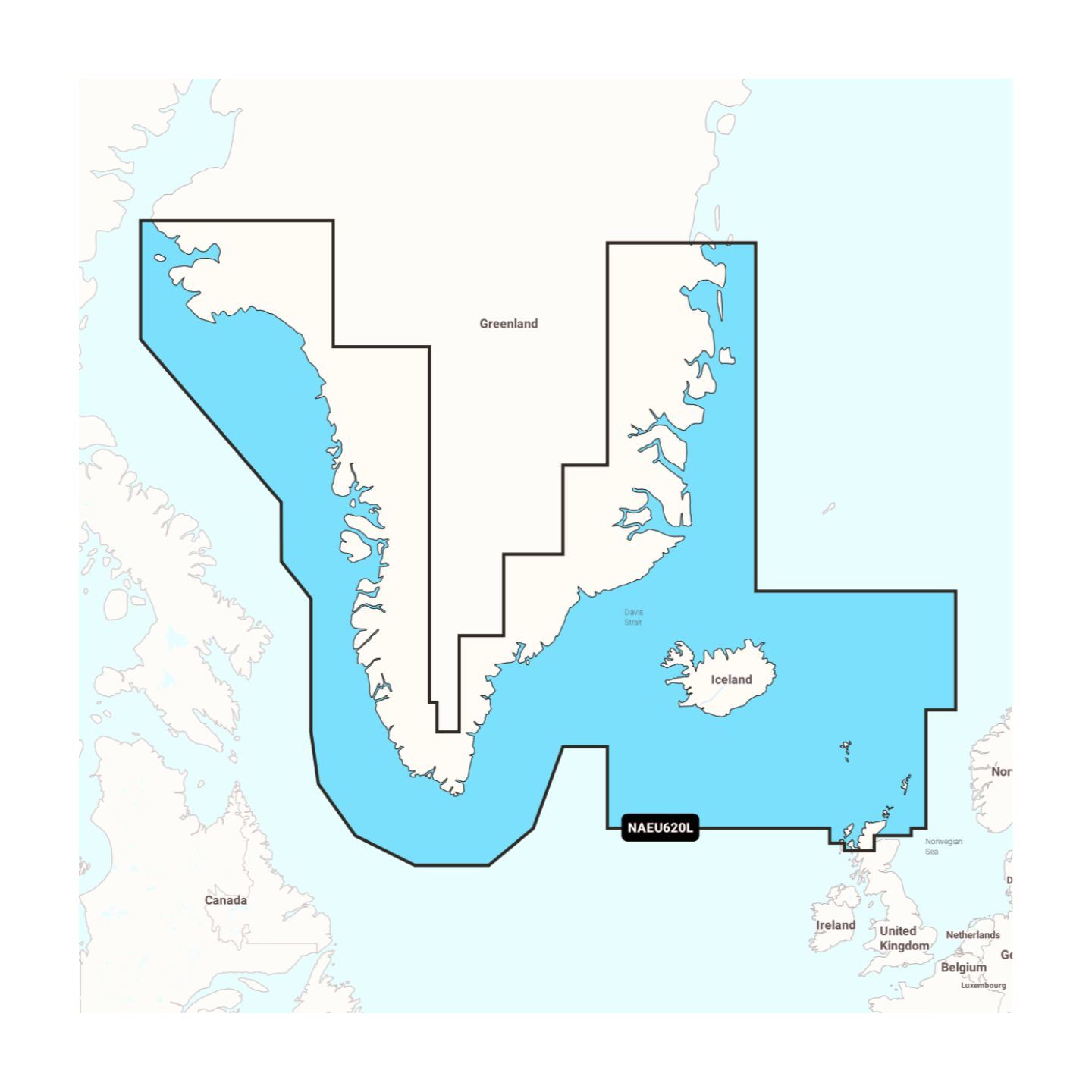
The Navionics+ NAEU620L provides one of the most extensive coverages for the northern oceans. This "Large" chart is designed for skippers who want to make no compromises and cover long distances in the North Atlantic. It combines the entire, complex coastline of Greenland with the complete circumnavigation of Iceland. Whether you are navigating through the ice-filled Disko Bay or exploring the deep fjords of Iceland's east coast – this chart offers maximum safety in one of the Earth's most extreme regions.
Coverage & Cartography
The Greenland & Iceland (NAEU620L) chart offers seamless large-area coverage:
- Greenland: The complete coastline of the world's largest island, including the west and east coasts, Nuuk, Ilulissat, and the remote fjord systems in the north.
- Iceland: Complete coverage of the Icelandic coast, including Reykjavik, Akureyri, and all offshore islands.
- Jan Mayen: The solitary volcanic island in the North Atlantic is also included.
- Passages: Optimal data for crossing the Denmark Strait between Greenland and Iceland.
- Ports: Highly precise plans for all settlements, supply ports, and sheltered expedition anchorages.
Top Features of the Navionics+ Series
Maximum precision for polar navigation and offshore sailing:
- SonarChart™ HD Bathymetry: Utilize high-resolution depth charts with 0.5m contour lines. This is vital in Arctic waters for safely identifying shallow areas in often inadequately surveyed fjords.
- Daily Updates: A 1-year subscription for daily updates is included in the purchase price. Use the Navionics Chart Installer to keep your data on ice conditions (where charted) and port changes current.
- Dock-to-Dock Autorouting: Automatically calculates safe route suggestions considering the complex coastlines and your draft.
- Community Edits: Benefit from the valuable experiences of other expedition skippers with tips on anchorages and local peculiarities in the Arctic.
- Plotter Sync: Wirelessly synchronize routes and waypoints between your plotter and the Navionics Boating App.
Compatibility
This chart comes on a microSD card with an SD card adapter. It is compatible with modern chartplotters from the following brands:
- Raymarine
- Simrad
- Lowrance
- B&G
- Humminbird
⚠️ Important Note: This Navionics+ chart is NOT compatible with Garmin chartplotters. For Garmin devices, you will need the Garmin Navionics+ or BlueChart series.
Technical Specifications
- Chart Code: NAEU620L (Greenland & Iceland)
- Manufacturer Part Number: 010-C1342-00
- Storage Medium: microSD / SD
- Language: English / International
Order now at waypoint-gps.de: Secure the Navionics+ NAEU620L and navigate the icy waters of the North with maximum coverage and precision!